Iceland is a bonkers-beautiful country, and just driving along the Route 1 highway (“the Ring Road”) is entertainment of itself. As you could probably guess, Route 1 is usually the only road for miles around, and it’s also usually the only visible human structure in the entire extraterrestrial landscape. A parade of natural attractions will flash past your windows and it’s hard to pick the “right” places to stop, especially when time is short. Luckily it’s virtually impossible to go wrong, and every single attraction is worth a stop…or two…or three. For real. Not one single stop we made was considered wasted time, and we actually revisited some places like Jökulsárlón glacier lagoon and the puffin beach (okay, Reynisfjara beach) just because we loved them so much. We crammed a lot into 7 full days on the southern half of the Ring Road, but there are only so many creative ways to describe waterfalls and ice. Here I’ve written a few more blurbs on my absolute favorite things we did, and stuck our daily itinerary at the end in case you’re looking for specifics. One final note I’ll make here, just because I think it’s awesome – all these attractions were free to visit! National parks, natural attractions, and Route 1 all have gratis entry (although you usually have to pay for parking and toilet privileges, thanks Europe).

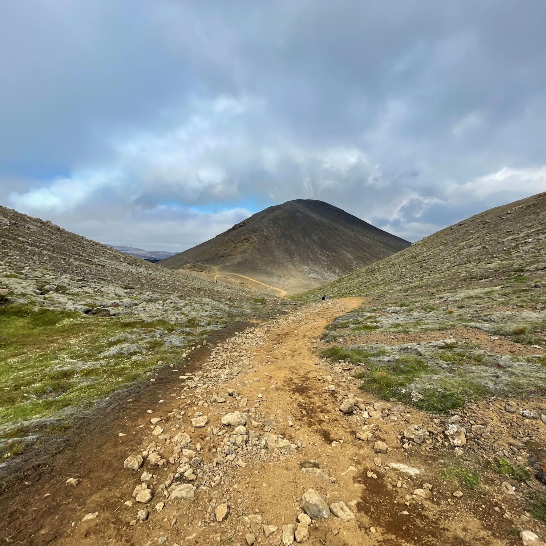

Ring Road scenery at Eyjafjallajökull, Fagradallsfjall, and Snæfellsnes peninsula
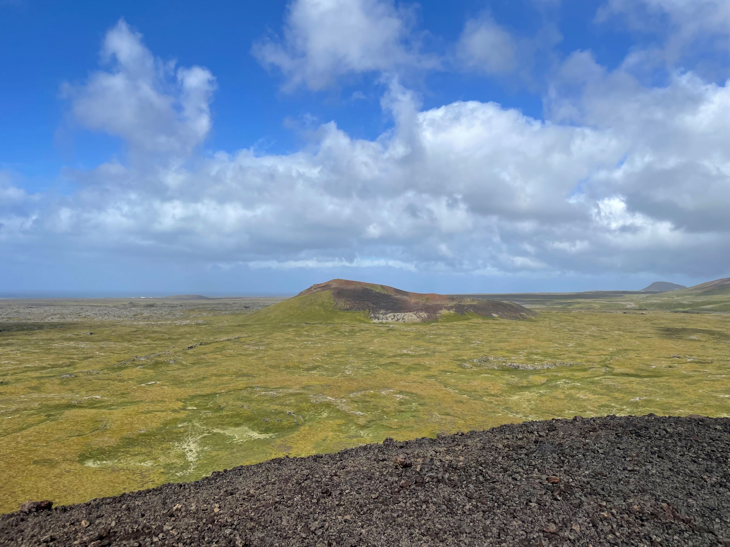
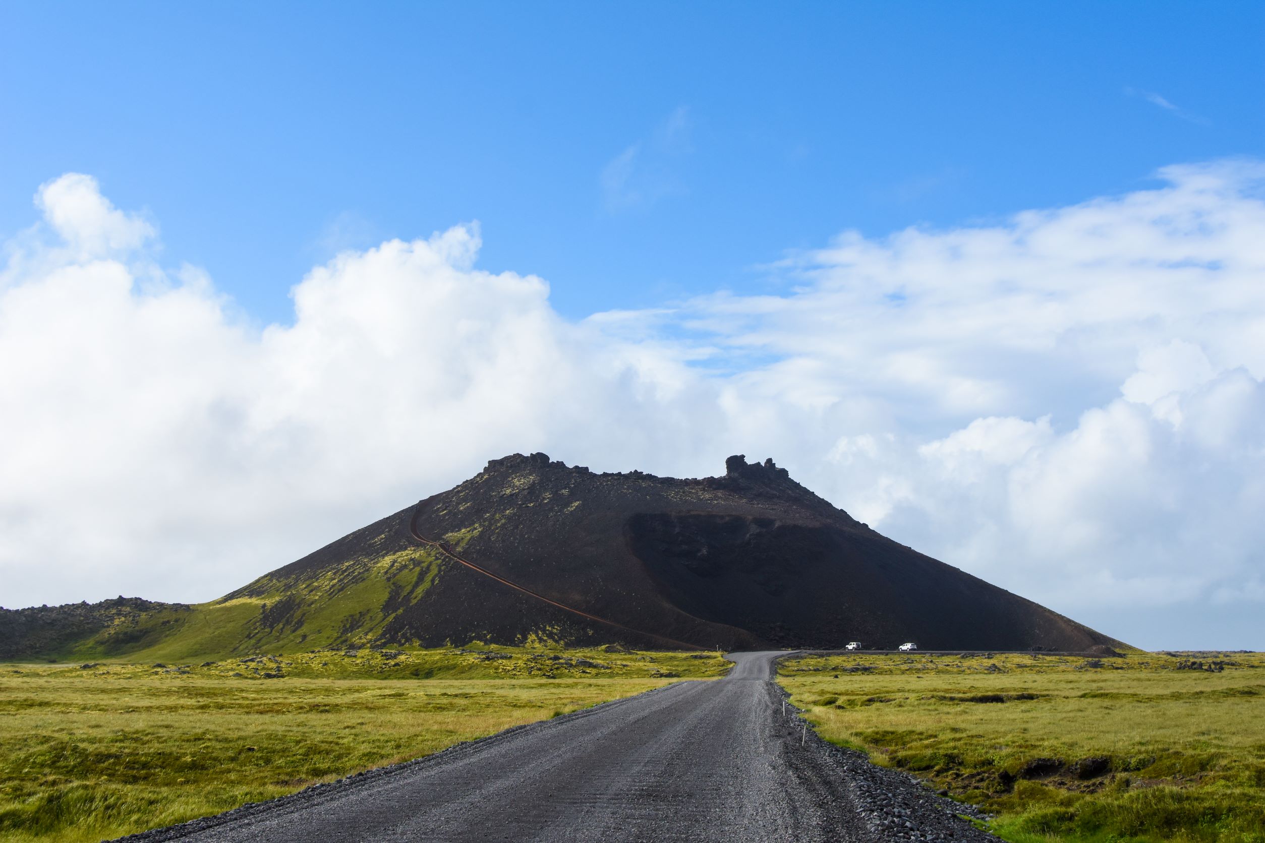
Cinder cones and shipwrecks in Snæfellsnes
The Icelandic weather gods are a fickle bunch. Half of our days were pretty great, but the other half we couldn’t see more than 20 meters down the road, and every day it rained at least a little bit. Then came our 24 hours on Snæfellsnes peninsula, where it was finally time to pay our dues for getting two almost-perfect sunny days at the front end of our trip. Squall after squall lashed at our tiny car and we white-knuckled it for hours, always ready to counteract a sudden gust that was hell-bent on shoving us off the tarmac. We would often see brighter skies up ahead and our hopes would leap, but somehow the brighter spots just meant it was raining harder over there! Still, we had an itinerary to follow and things to see, dammit, so we stopped and got out a couple times. We wrapped ourselves in every warm and waterproof layer we’d brought, held on to our car doors with both hands as we opened them into the wind, and – you guessed it – were soaked within seconds.
Luck finally tossed us a bone after we made an incredibly dodgy journey over the mountain pass near Snæfellsjökull volcano. We’d just descended to the northern shore of the peninsula, exhausted and ready to find a cafe in Ólafsvík where we could hunker down and wait out the weather, when the impenetrable cloud cover abruptly broke, so we chased the sun into Snæfellsjökull National Park instead. This peninsula is dotted with black-and-maroon volcanic geological features called “cinder cones,” which are old volcano vents made of small loose gobs of volcanic ash and cinders. Saxhóll Crater is one of the most accessible and has a steel staircase that leads up to the rim. The clouds and rain had momentarily backed off but the wind absolutely had not, and I’m not joking when I say we had to crouch down to avoid being knocked flat. We scurried up to the top and stayed just long enough to take pictures of the moonscape view, then gremlin-crawled on all fours back down the stairs and managed to slam the car doors just before the first raindrops of another squall pattered against the roof of the car. Great success!
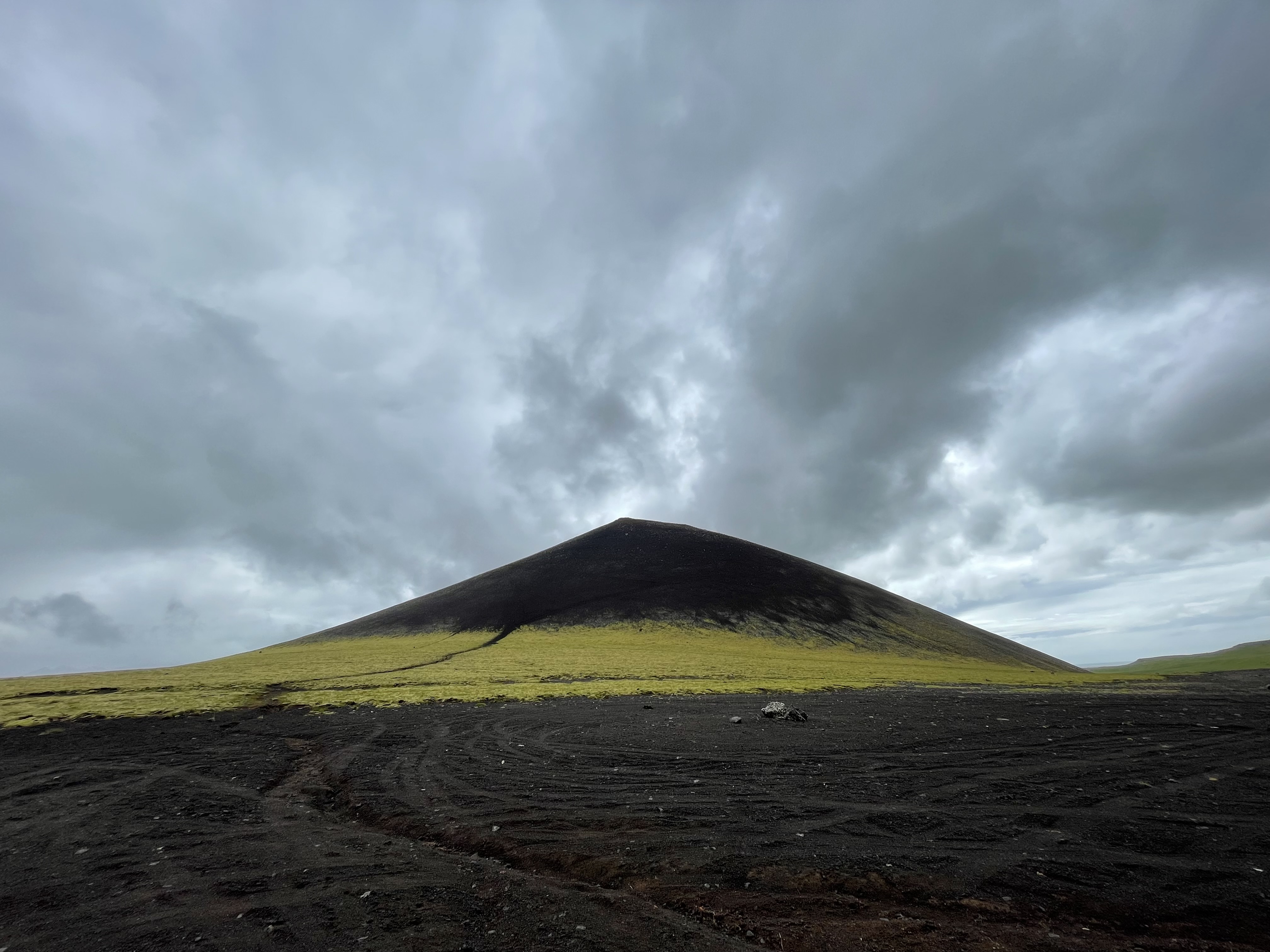
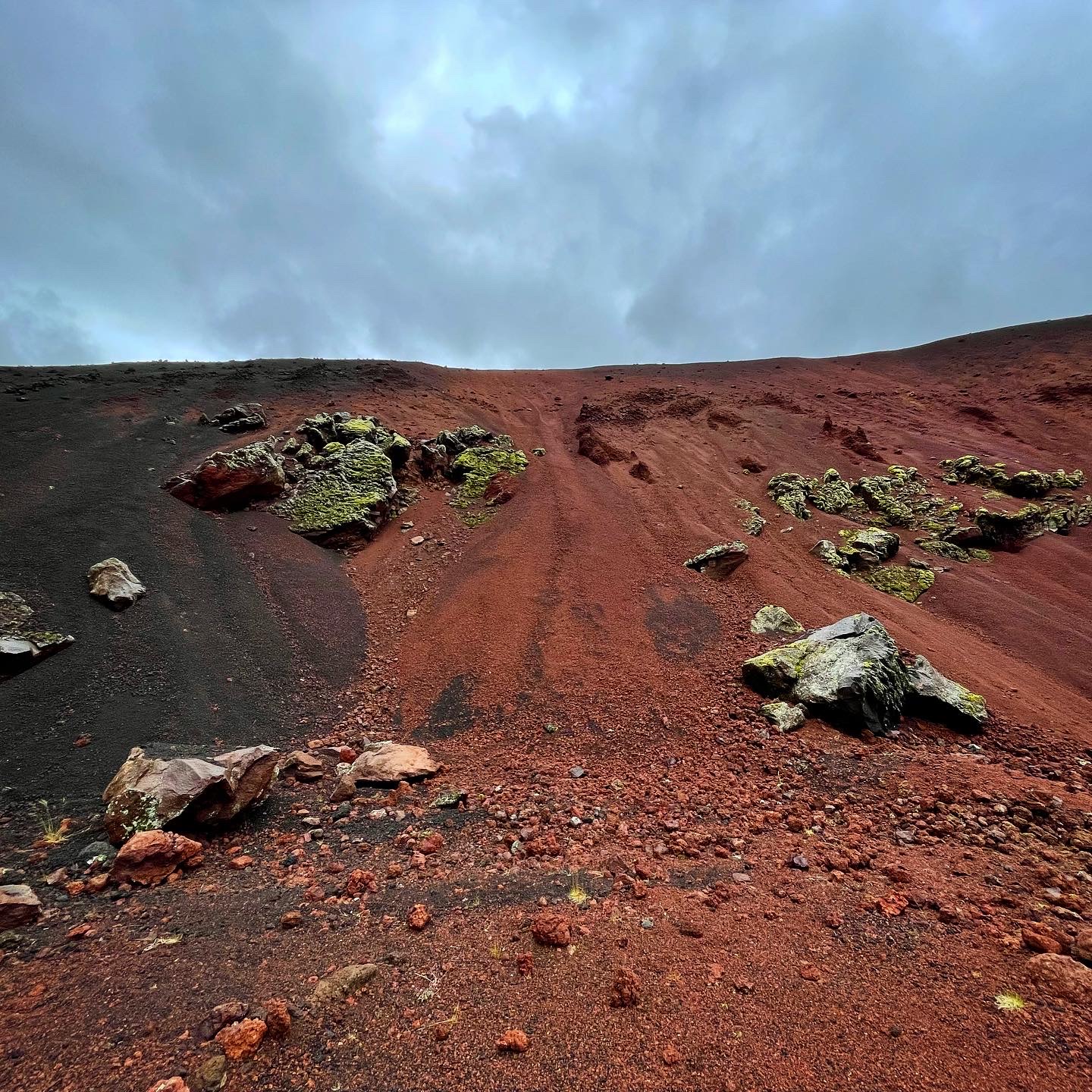
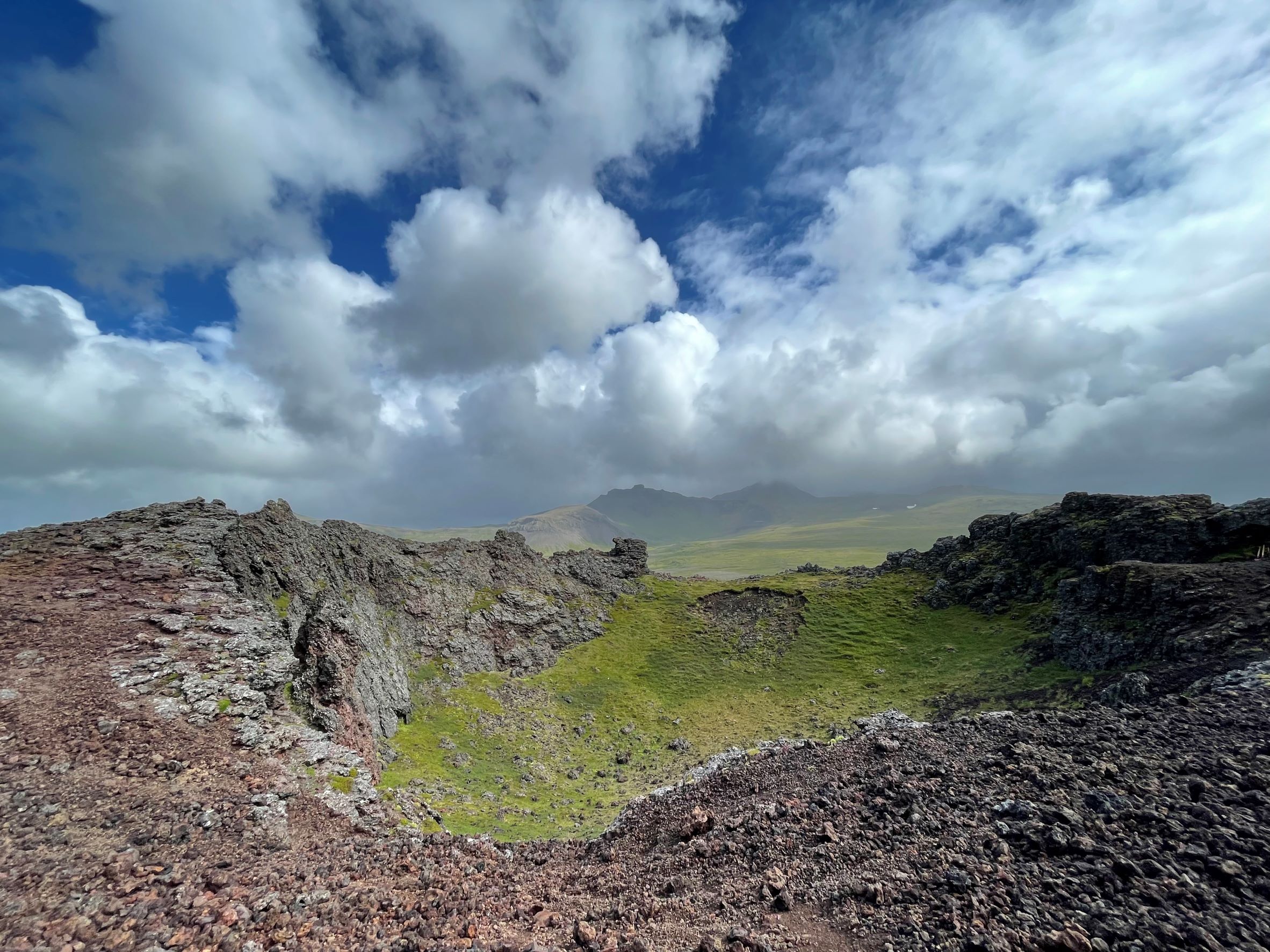
Clockwise from top left: View from Saxhóll crater, Ytri-Raudamelskúlur cone (top) and oxidized cinders (middle), Saxhóll crater innards, Saxhóll crater from the Ring Road showing the staircase.
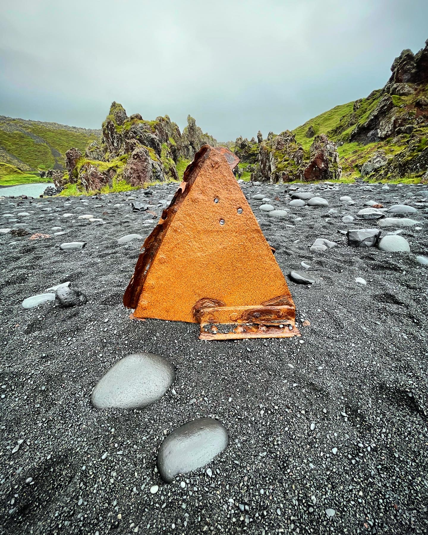
Naturally, the capricious weather gods have also wrecked a fair number of ships around the peninsula. A bit further south down the coast from Saxhóll is Djúpalónssandur (Icelandic for “Black lava pearl beach”), colloquially dubbed “Shipwreck beach” after bits of rusted iron from a 1948 shipwreck started washing ashore. If you know me, you’ll know this is the definition of my living nightmare. I have this TOTALLY REAL CONDITION called submechanophobia, meaning I have an irrational fear of submerged human artifacts, including things that were previously submerged but have since been tossed ashore. Yes, I know it’s weird, let’s move on. Luckily I had my aunt along to protect me from the shipwrecky bits and any associated ghosts. I even got within arm’s distance of the iron, but I took painstaking care to not to disturb any of the pieces. I’m happy to report that I am not currently being haunted!
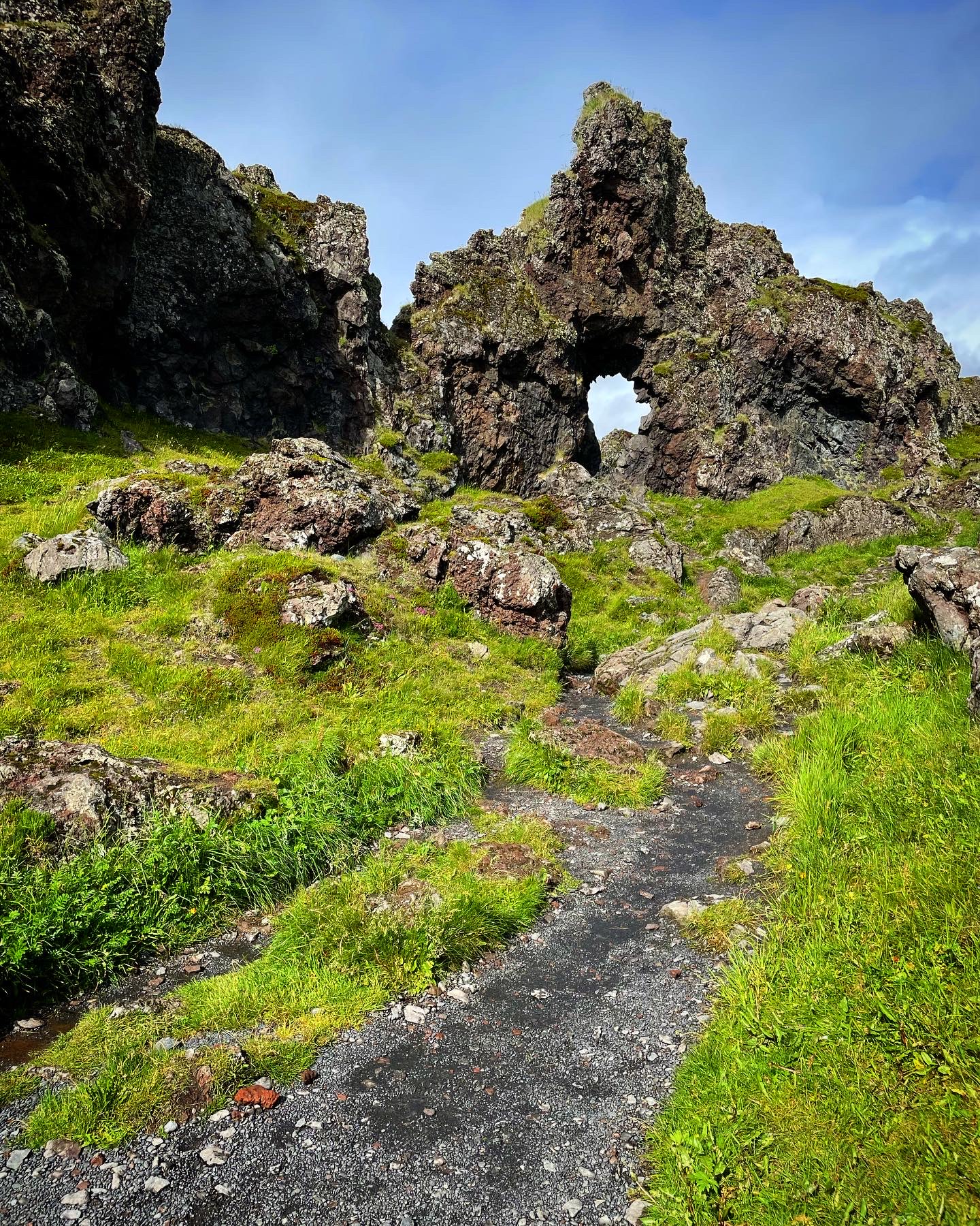
A wonderful trail wanders south along the bluff above the sea, and we wandered with it for about 10 minutes (again playing do-we-go-back-to-the-car-yet-because-it-sure-looks-like-rain chicken) until we reached a headland with a viewpoint over the next wild beach, which was absolutely filled with catastrophic waves and seastacks and not a single human or raindrop in sight. We even saw a tiny arctic fox devouring a seabird. Only after we were driving back north and literally chasing a rainbow did the rain finally sock us in again, but at least we got our two hours in the sun.

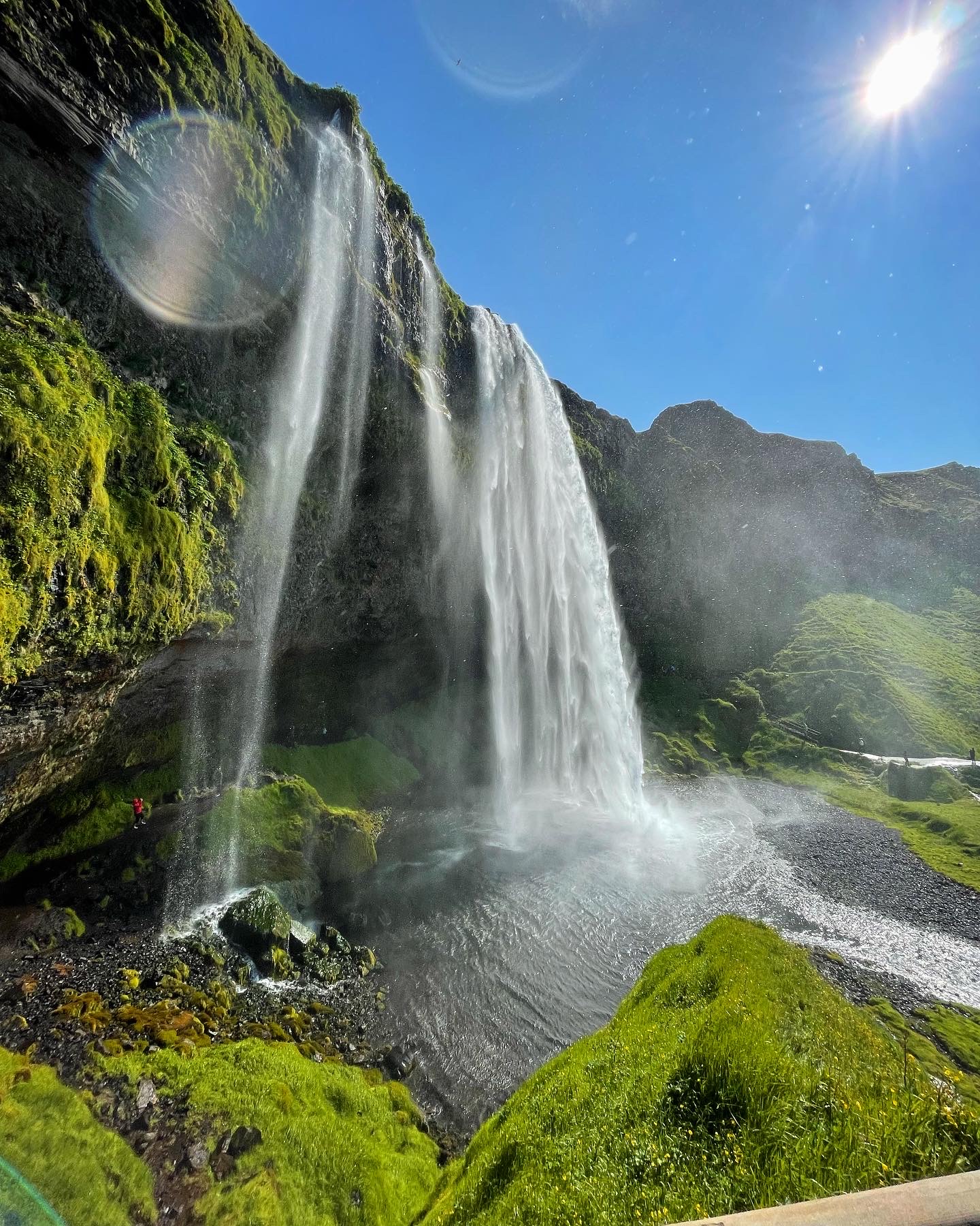
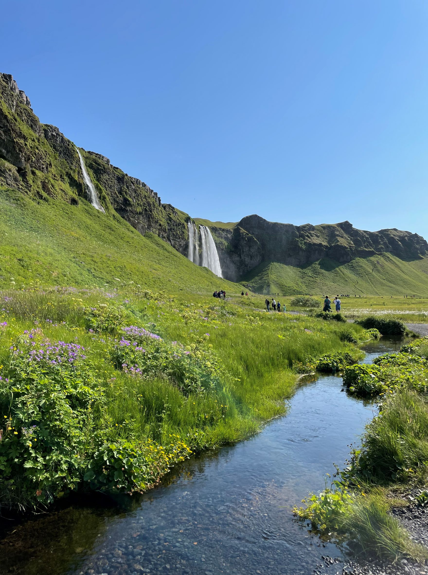
Gljufrabui and Seljalandsfoss waterfalls
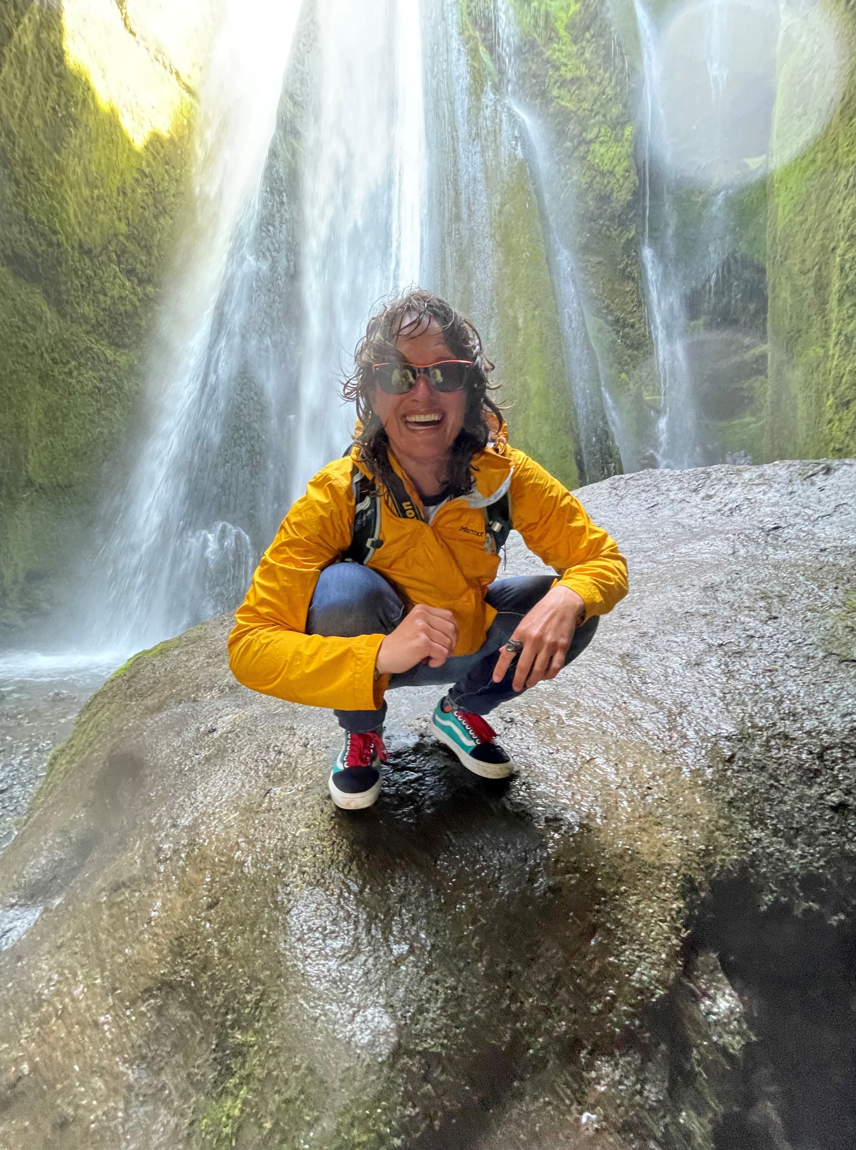
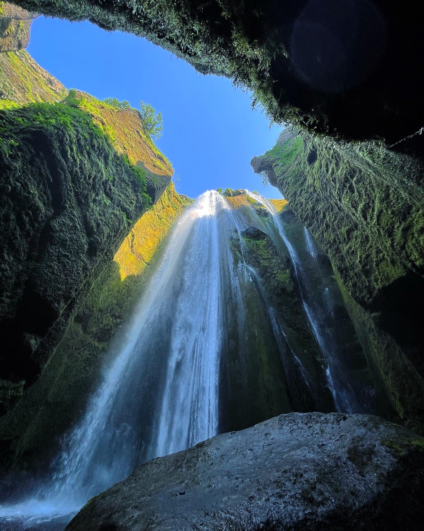
Visible from the Ring Road, a string of waterfalls spills from the top of a shelf-like bluff. Like the fat lady at the opera, Seljalandsfoss waterfall is the undeniable star of the show because she’s enormous and boy can she sing. There’s a trail that leads all the way behind it and out the other side, which is wet and slippery and awesome and worth it. After you’ve ogled the big-ticket attraction, don’t leave yet. Take the gravel path along the base of the bluff that leads north away from the Ring Road. Horsetail waterfalls literally pop out from holes in the side of the cliff – old lava tubes make great paths for underground rivers. Keep going about half a mile and you’ll find a second waterfall that pours into tiny slot canyon and is entirely hidden from outside eyes: Gljufrabui (“one who lives in a canyon,” how whimsical). From the trail, the only indication of the waterfall’s existence is a small creek exiting the cave. Wrap yourself (and your camera) in waterproof everything before entering the canyon. You’ll still end up soaked (again), but it’s incredible to stand inside the mist tornado and feel the waterfall’s power.

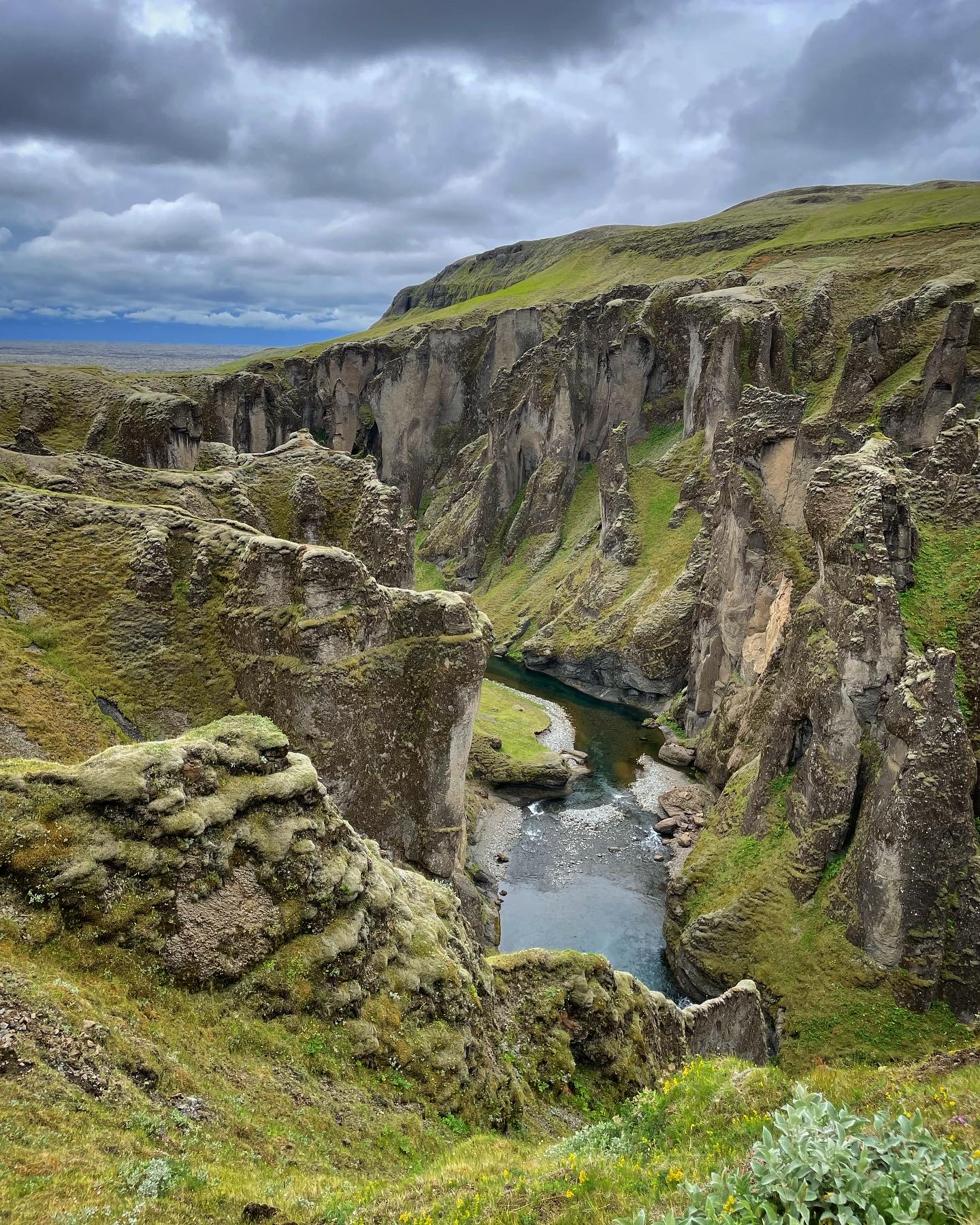
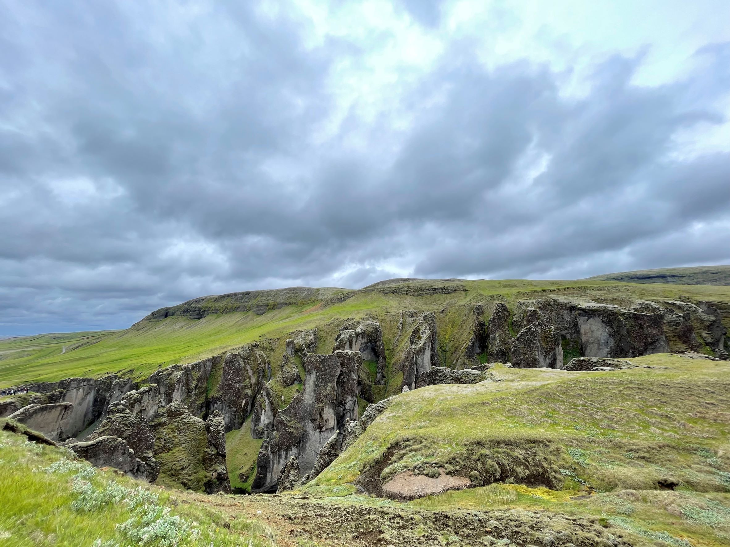
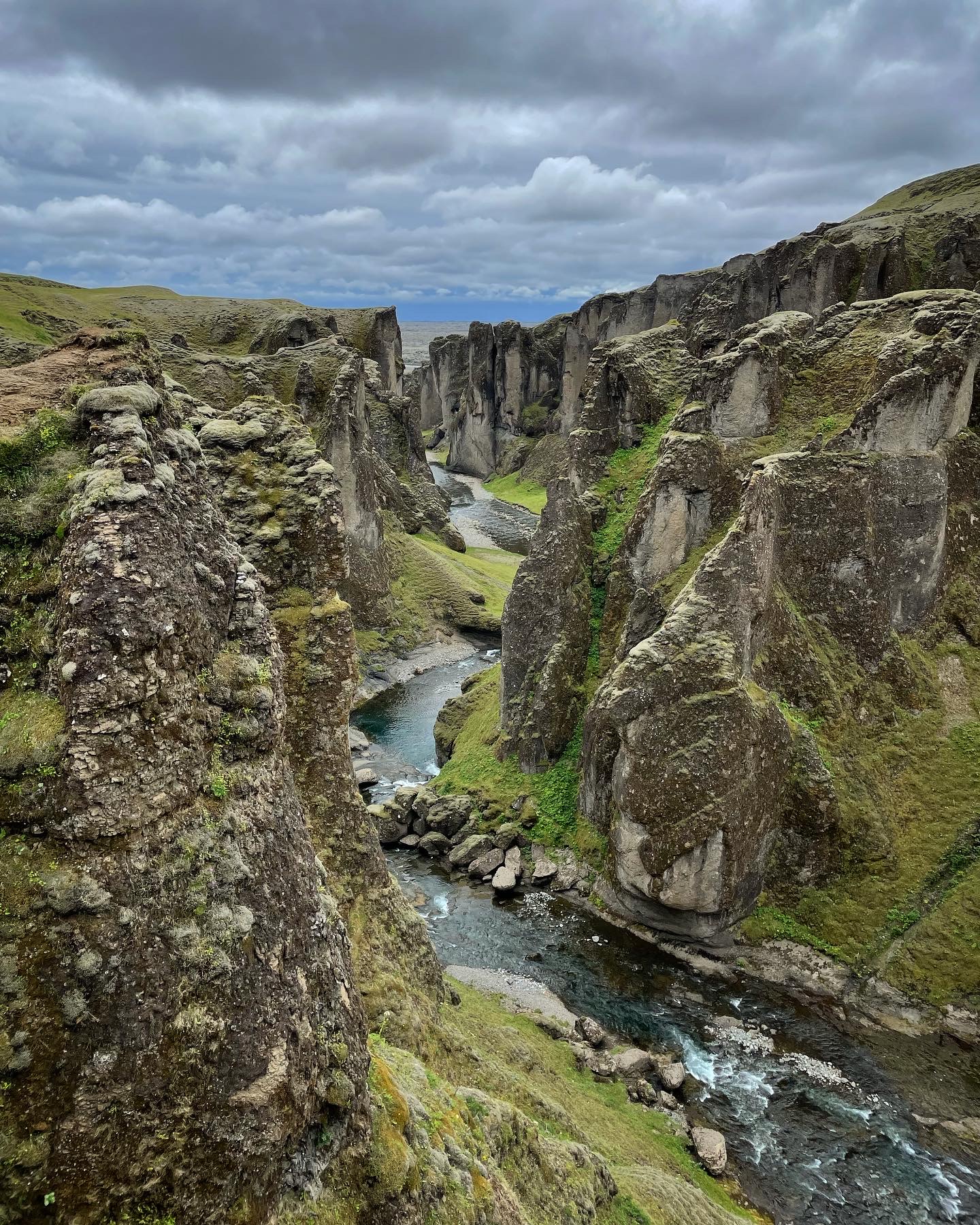
Fjaðrárgljúfur canyon
I think at some point, the Vikings ran out of names for places and just started throwing knives at a board full of letters instead. Seems like a pretty Viking thing to do, right? Despite having a name only a motherland could love, Fjaðrárgljúfur canyon is unique even for Iceland. It sits at the edge of a lava field so old that it’s crumbled into bowling-ball-sized chunks. Carpets of 200-year-old moss have colonized every scrap of land, coating the lava field and canyon with a distinguished green-grey tinge. The patina is somewhat misleading since Iceland is the world’s geologically youngest country and its canyons are still shallow, but Fjaðrárgljúfur retains a sense of grandeur. A gently sloping trail leads up along the canyon’s edge about one mile to a viewing deck.
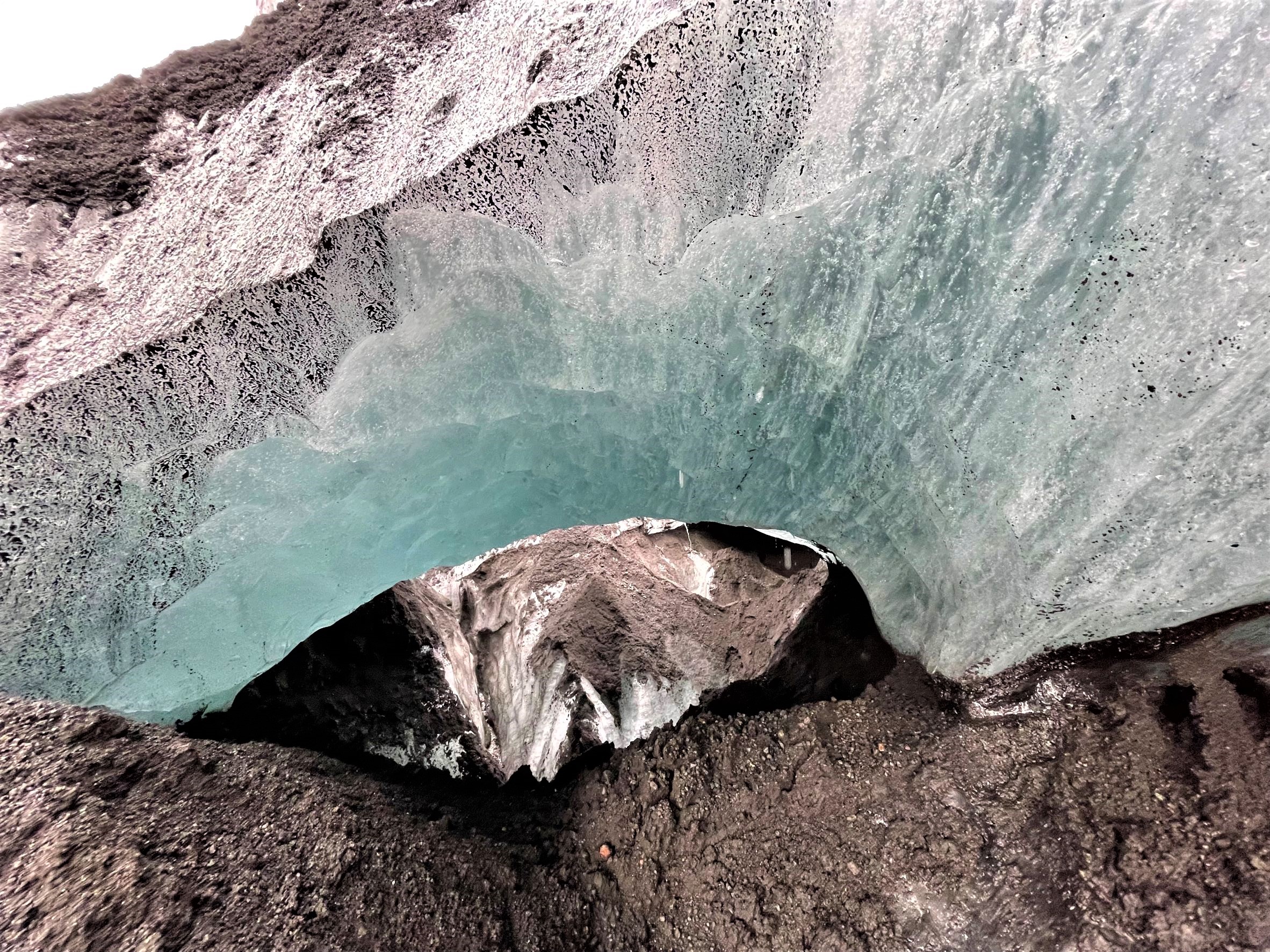
Touch the ice of Sólheimajökull glacier
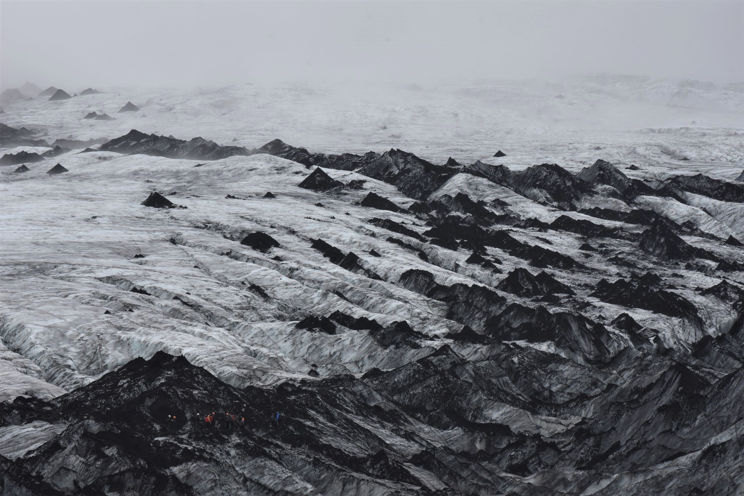
Most of Iceland’s glaciers require a very long hike or a very long drive to reach, but Sólheimajökull (“home of the sun glacier”) didn’t get the memo. It’s a 5-minute gravel drive off the Ring Road then a 10-minute hike down a flat trail that follows the lagoon shore. The trail literally ends at the foot of the glacier, an insane wall of ice that’s close enough to touch without leaving solid ground. Mysterious black cones of sand are piled all over the top of this glacier and give it a particularly eccentric vibe. You can see deep into the glacier’s guts from shore, with all its ice arches, caves, crevices, and meltwater rivers churning through hidden tunnels. You might even get lucky and see a new iceberg calve off into the cappuccino-coloured lagoon. There are some trails that lead up on top of the glacier, but these are exclusively meant for the guided tours and you should heed the warning signs: glaciers are extremely dangerous to walk on without an experienced guide because the ice is constantly melting and there’s always a chance the solid-looking ice might be hiding a deep crevice underneath. There are several paid guided tours you can take at Sólheimajökull and other nearby glaciers if you really want to scramble around on the ice.

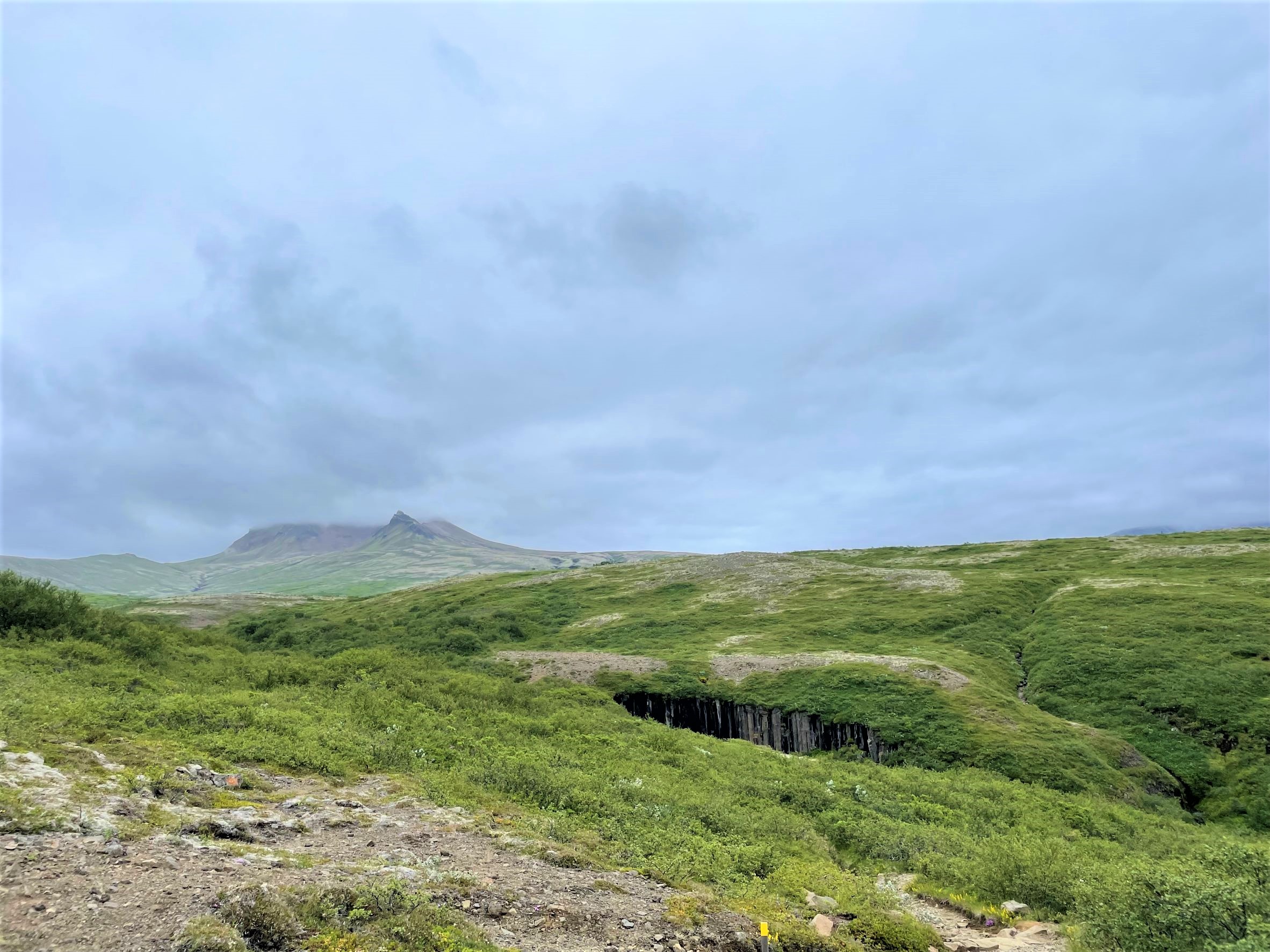
Svartifoss basalt waterfall
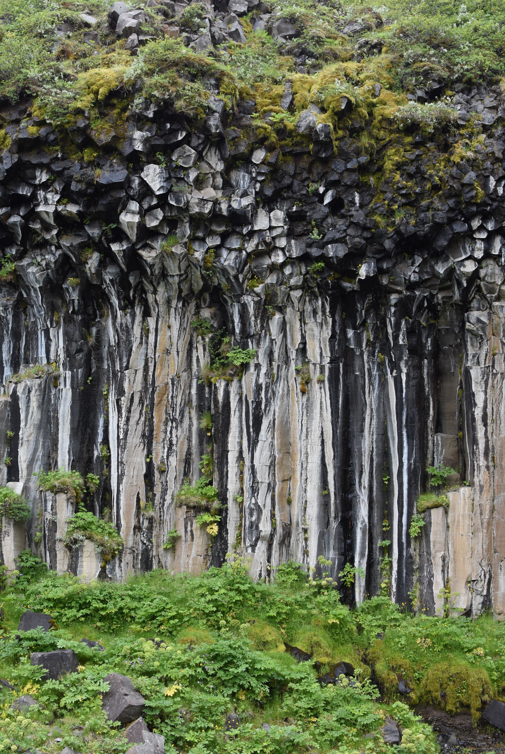
Full disclaimer: I am obsessed with hexagonal basalt columns. I think it’s because they’re so alien-looking, like they’re not of this Earth, and also because they were made inside the bellies of my beloved volcanoes. Svartifoss (“black falls”…scraping the bottom of the barrel there) is a horsetail waterfall that tumbles into a canyon bowl made from basalt columns, so I about lost my mind. This waterfall is at the end of a really popular 1-mile uphill hike and there are actually two trails leading to it, but apparently the second one is a secret that no one knows about even though it’s clearly marked both on the ground and in Google Maps. The secret trail also has a tiny optional spur that leads to an awesome panoramic viewpoint from which you can see nearby glaciers and all the way out to the sea. What more could you need?
Regardless of whether you choose this totally awesome secret trail or the regular one, everyone starts on the same path from the parking lot. After about half a mile, just after the second small waterfall, you’ll come to a well-marked fork with a wooden footbridge leading left across the river. The main path goes right/straight without crossing the river (note: this one is graded with anti-erosion devices, so it might be easier for less sure-footed people). If you want to take the path less traveled, cross the river via the footbridge and head uphill. The path leads up through shrub land and then open grassland with a phenomenal view. The optional spur is at the crest of the trail where it begins to curve right, and again it’s clearly marked. You’ll eventually descend into the river gorge again, popping out right at the base of Svartifoss. Aaaaah! Do you hear the angels singing? Look at the columns, how they bend over like straws! Check out the hexagonal boulders strewn all over the canyon! See the guy clambering over the barrier and ruining everyone else’s pictures! Seriously, don’t be that guy.
The trails rejoin at this point, so you can return either way. We opted to do it as a loop, taking the busy trail up and the quiet trail down to get the full experience.


Svartifoss and the secret trail
A note on the Golden Circle
We started our trip with the famous Golden Circle, like many who came before us. It was beautiful and we enjoyed it, but here’s the thing: it’s basically Iceland in miniature. I think if you’re based in Reykjavík, a Circle tour is a perfect day-trip way to get a taste of grander Icelandic landscapes. However, if you’re doing a longer Ring Road trip, you’re gonna get the full Monty of grandiose landscapes, so the Circle might be skippable if you’re looking to shave off some drive time. If you are going to do it, it’s probably best enjoyed at the front end of your trip as an appetizer for what Iceland has in store.
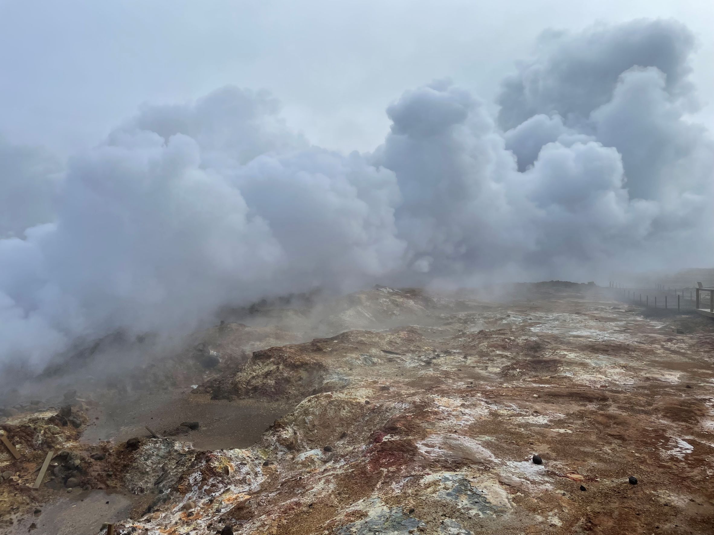
My favorite parts of the Circle were Strokkur geothermal park, Gullfoss waterfall, and the continental divide in Þingvellir. If you’d like to see similar things without the crowds, I recommend going south to Reykjanes peninsula instead. Gunnuhver geothermal area has a constantly-erupting geyser, compared to Strokkur’s split-second explosions every 5-8 minutes, and the nearby Reykjanes Lighthouse area is gorgeous. The Bridge Between Continents has a canyon between the North American and European tectonic plates that you can actually run around in. And while Gullfoss is the largest waterfall by volume in Iceland, the southeastern part of the Ring Road has plenty of other unbelievable waterfalls too.
That said, to each their own! We did enjoy the Circle, it’s just the one thing we did that I’m not sure I’ll revisit.

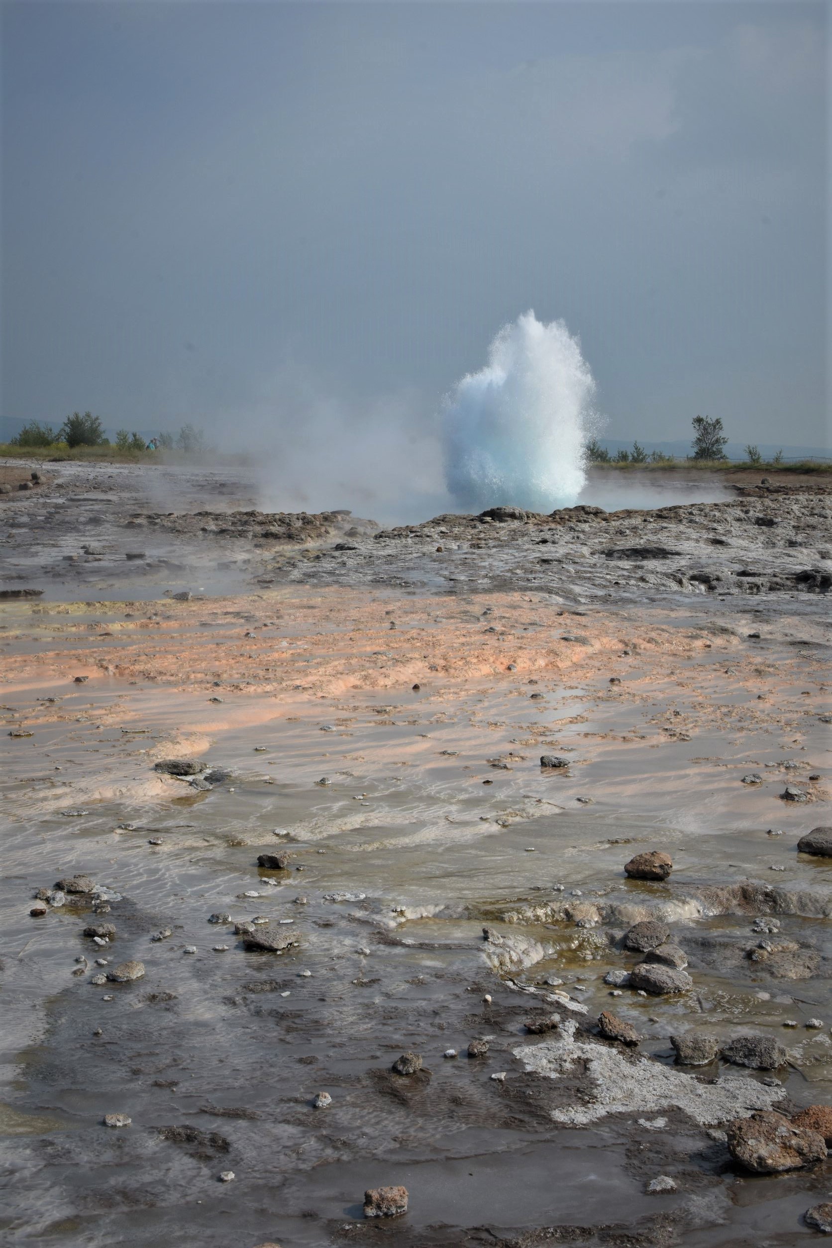
Left top: Continental divide in Þingvellir, left bottom: Bridge between continents, right top: Strokkur geyser, right bottom: Gunnuhver geothermal area
Our Route
We initially planned to do the whole Ring Road circumnavigation, but 7 days didn’t feel like enough time to do it justice. Instead we did an out-and-back from Reykjavík to Höfn, with a one-night side jaunt to Snæfellsnes peninsula at the end. You can see our general route here. In the end we were glad we did out-and-back, because it gave us two chances to see everything in case the weather betrayed us on the outward journey (which obviously happened a lot). We stayed for two nights at the cute farm Guesthouse Nýpugarðar near Höfn which allegedly has a stunning view of Iceland’s largest glacier, but thanks to the fog rolling off the nearby sea, we never once saw the ice! The out-and-back didn’t shave off that much drive time and we still did around 1000 miles, which was 22 hours just driving, but the way back was leisurely since there was no pressure to stop anywhere besides places we knew we’d loved, places we’d skipped for weather, or B-list itinerary ideas that we’d skipped for time on the way out.
Daily Itinerary
I only name the hotels and restaurants that I’d recommend!
Day 1 – KEF airport to Reykjanes peninsula. We stopped at Gunnuhver geothermal area and Reykjanes lighthouse (1 hr), Bridge between continents (20 min), and Fagradalsfjall volcano (no longer erupting, sorry!). We stayed the night in Reykjavík and did a short impromptu walking tour of the city’s main drag. We also stocked up on small Iceland souvenirs to get that task out of the way, which ended up being a good idea because souvenir stores are less ubiquitous across Iceland than you’d expect.
Night 1 – Reykjavík: Sunna Guesthouse. It’s right across the street from Hallgrimskirkja and within easy walking distance of the main drag. Driving through downtown was surprisingly zero-hassle. We had dinner at Lebowski Bar, which has good burgers and every kind of White Russian you never knew you wanted to try.
Day 2 – Golden Circle, with stops at Strokkur geothermal area (30 min) and Gullfoss waterfall (20 min). Continued onto the Ring Road to Vik, with stops at Seljalandsfoss and Gljufrabui (1 hr), Skógafoss waterfall and about a one-mile round-trip hike along the adjacent Fimmvörðuháls waterfall trail (2 hr), Dyrholaey puffin watching (1.5 hr), Reynisfjara beach (30 min).
Night 2 – Vík; dinner at Ströndin Bistro and Bar. Good pub food.
Day 3 – Ring Road to Höfn area. Stopped at Eldhraun lava field (15 min), Fjaðrárgljúfur canyon hike (1 hr), Svartifoss waterfall hike (1.5 hr), Svínafellsjökull glacier (30 min), Jökulsárlón lagoon and Diamond Beach north of the outflow river (1.5 hr).
Nights 3 & 4 – Guesthouse Nýpugarðar, situated on a working farm. They have an in-house restaurant open for breakfast and dinner with a limited but tasty menu (mainly daily-catch fish and lamb burgers).
Day 4 – Breather day. We mostly stayed near the guesthouse since the weather was awful. We returned to Jökulsárlón lagoon and Diamond Beach south of the outflow river, which had way bigger icebergs than the northern beach – I think wind direction and tides had something to do with this. We swung by nearby Fjallsárlón glacier lagoon too, but Jökulsárlón was by far our favorite. We stopped at Hoffell hot tubs, which were shallow open-air plastic tubs filled with geothermally heated water. They were basic, but a nice place to hang out and rest our bodies after hiking so much.
Day 5 – Returned along the Ring Road to Selfoss. We swung by Jökulsárlón again on the way back because we were obsessed. We also stopped at Hjörleifshöfði and Yoda cave (30 min), returned to Reynisfjara beach to catch up with the puffins, and did the short Sólheimajökull glacier hike (1 hr).
Night 5 – Little cabin at Gesthus Selfoss. Quiet area and basic self-contained cabins.
Day 6 – Selfoss to Snaefellsnes peninsula. We stopped at Ytri Tunga to try to see some seals, but the weather was so bad they weren’t ashore, then on to Saxhóll crater (30 min) and Djúpalónssandur beach and the short bluff trail south (1 hr).
Night 6 – Overnight in Grundarfjörður, Bjargarsteinn Mathus for dinner. This was our only meal-splurge and it was definitely worth it! Lots of fresh fish options on a constantly changing menu.
Day 7 – Return to Sandgerði on the Reykjanes peninsula, close to the airport. We stopped along the way at Arnarstapi’s sea cliffs (30 min; in better weather there’s a longer cliff walk), Gerðuberg Cliffs (20 min), and we looked at but didn’t climb Ytri-Raudamelskúlur cinder cone (20 min). We capped off our trip with a soak at the famous Blue Lagoon (2 hr).
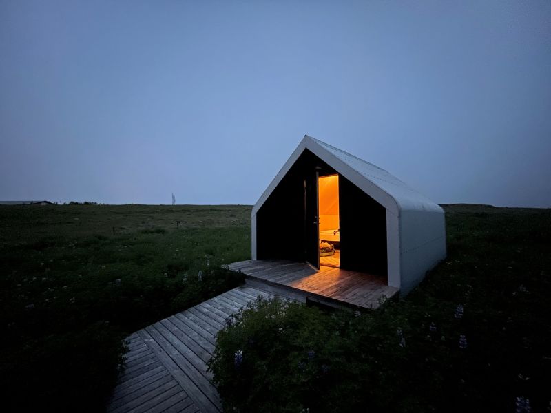
Night 7 – iStay cottages in Sandgerði, a quiet 8-minute drive from the airport. I actually arrived the day before my aunt so I stayed here my first and last nights. It was my favorite lodging of the trip, since it’s a super cute and secluded place to be. The cabins are basic but comfy and they look out onto a beautiful field filled with lupine and seabirds, and there’s a separate shared kitchen and common area building.
Day 8 – Fly out

Leave a comment